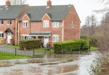
Paul Nathanail, managing director of specialist environmental consultancy Land Quality Management Ltd discusses climate change and how new technologies will help in assessing flood risk
At the end of October, the Committee on Climate Change (CCC) issued Managing the coast in a changing environment. The CCC report presents the building and planning control sector with both challenges – to deliver long-term resilient housing – and opportunities – to make best use of available information when deciding on where to build new homes, and how to build them.
Rising seas will swamp homes[1] was how the BBC website apocalyptically – perhaps that should have been cataclysmically – headlined a summary to the CCC findings. Britain’s growing and increasingly valuable coastal infrastructure faces rising threats from flooding and coastal erosion. A 1m rise in sea level is “almost certain”. Even a 0.5m sea level rise means 20% of England’s flood defences are vulnerable to failure.
Speaking earlier last month, Sir James Bevan KCMG, Chief Executive of the Environment Agency[2] noted that history, and the map, are equally good guides whether you want to understand foreign policy or flooding – and in particular surface water flooding.
A growing threat
He described flooding as a real and growing threat to life, to property, to the economy, to the country. Yet the CCC report warns that public have neither map nor history: they “do not have clear and accurate information about the coastal erosion risk to which they are exposed, nor how it will change in future.”
The message is clear: rising sea levels are expected; they will increase flooding, erosion and land-sliding to an extent where vulnerable infrastructure will face increased risks, for which, in the words of the CCC, we are not prepared. Seldom, if ever, has the saying “failing to prepare is preparing to fail” rung more true.
Preparing for flood risks
Preparation begins with understanding. Not the broad understanding that sea level rise is happening and brings danger with it. Rather, detailed understanding of the likely effects of a rising sea level on potential development sites and on nearby land; after all the water has to go somewhere. Such understanding begins with detailed information on site elevation and on the ground below.
The land use planning system has failed to stem development on land prone to flooding; this despite both the 2012 and 2018 editions of the National Planning Policy Framework having a presumption in favour of sustainable development. Yet we continue to build thousands of homes every year on land susceptible to flooding and whose construction puts nearby homes at risk of flooding.
The role of information in assessing, responding to – and hopefully preventing –risks from flooding and coastal erosion is highlighted several times by the CCC.
I was intrigued to see my friends over at Landmark Information Group, host a hackathon[3] to explore how artificial intelligence and machine learning can be used to improve our understanding of flooding and related hazards as they affect property. It seems as if ‘the map’ is being drawn from history; and just in time too.
A personal view and guest blog writtenfor Argyll Environmental by Paul Nathanail, managing director of specialist environmental consultancy, Land Quality Management Ltd.
Paul combines cutting edge consultancy with expert witness, specialist training and technical guidance writing. This is one of an occasional series of blogs exploring how we can deliver more housing, safely, quicker and more cheaply, especially on post-industrial brownfield sites.
#TLDR Climate change will cause 1m sea level rise around England’s coast, threatening infrastructure & homes. Better public understanding of risks may result from AI & machine learning initiatives
[1] https://www.bbc.com/news/science-environment-45983260
[2] https://www.gov.uk/government/news/surface-water-the-biggest-flood-risk-of-all
[3] https://www.landmark.co.uk/news-archive/emerging-technologies-hackathon-held-inspire-ai-and-machine-learning-innovation


