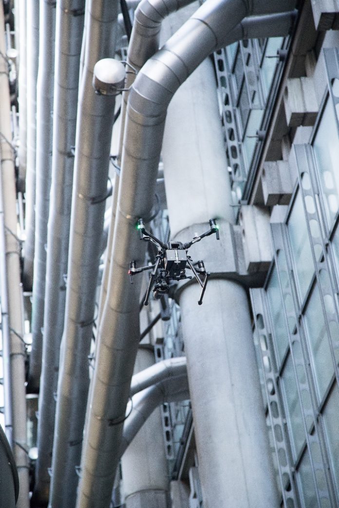
Unmanned Aerial Vehicles (UAVs) have been used to undertake a survey of the Lloyd’s building’s external façade in the heart of the City of London. Russell Cole, leader of façades UK at Arup, discusses this challenging project and the potential of drones in surveying dense urban areas
Digital transformation has become something of a buzzword of late, yet the benefits have been felt across many an industry as employers race to adopt the latest technologies. The engineering sector is no different, as we look for innovative new ways to carry out a variety of tasks. Indeed, the use of Unmanned Aerial Vehicles (UAVs/drones) to transform surveying and modelling is a case in point.
Drones enable enhanced efficiency and accuracy for the capturing and analysis of site data. Using UAV, the data can be obtained and processed in less than two days. The point cloud data can then be converted into a 3D model, providing a 100% spatially accurate replica of the site. With additional processing, its layers can be separated and exported into computer-aided design and geographic information system mapping for further design and planning evaluation.
Reducing risk while saving time and money
The recent survey of the iconic Grade I listed Lloyd’s building in the capital – one of the first UAV façade surveys undertaken in the City of London – is an exemplar of this method in practice. Now, this isn’t your average tall building. To maintain the 88m soaring structure with its striking 4,500 linear metres of external stainless steel-clad pipework and 12,000 sq m of glazing takes a lot of effort and ingenuity.
The annual survey of the external façade commenced last September, aimed at the identification of any defects, particularly in those hard-to-reach places, that require remediation.
Previously, this has been completed using the traditional method of rope access (abseiling). However, for the very first time, UAVs were used for 80% of the 2020 survey, reducing risk while saving time and money. That’s not to say that abseiling is completely eliminated – as we anticipated, 20% of the façade still required a “hands-on” examination.
As I alluded to above, this was somewhat unchartered territory for us, for Lloyd’s and, to a certain extent, for the City of London. As a result, there was some necessary housekeeping that needed to take place before we were able to proceed. Indeed, Lloyd’s itself played an instrumental role here.
Flock, an insurtech start-up which took part in the Lloyd’s Lab mentoring programme in 2019, pioneered a flexible insurance product with integrated third parties and invasion of privacy cover. This has allowed commercial UAV equipment to be used for this type of work.
There are, of course, a number of strict rules in place that must be adhered to, such as the type of drone being used, which must always be in line of sight and have a predesigned automated flight plan. Furthermore, The VirtuLab, a creative and technical innovation lab, who we partnered with for the UAV flying itself, needed CAA approval and NATS clearance. Road and pavement closure permits from the Corporation of London were also required when flying over the public realm.
In terms of the process, one of our façade engineers viewed the screen of the drone operator and directed its movements to ensure we were capturing the necessary detail. Our work with VirtuLabs will continue as we undertake the detailed inspection of the available data of the façade. We will use the images from the drone flights to undertake the inspection of the captured images and update the existing 3D virtual maintenance model of this unique heritage asset.
This digital building and conditional information model is a unique and project-specific interactive tool called Arup Inspect 3D, which records conditional observations and any change over time. It also captures planned maintenance and remediation activities through the lifecycle of a building or asset, allowing us to appropriately plan for the future.
There can be no doubt that UAVs have come into their own amidst the global pandemic that we’ve found ourselves in over the last year. The remote access functionality has ensured that crucial works are still able to continue, sensitively navigating lockdown restrictions, including social distancing measures.
And acting as the prototype, the survey on the Lloyd’s building demonstrates the potential for the use of UAVs in densely populated areas. As we take gradual steps to recovery and look towards a post-Covid world, the convenience and accuracy that this method provides will allow us to give heritage buildings the care and attention that they deserve.
Russell Cole
Leader of façades UK
Tel: +44 (0) 20 7755 2439
LinkedIn: Arup


