Highways maintenance provider, Amey is trialling drone technology in a bid to identify defects on roads in and around Kent
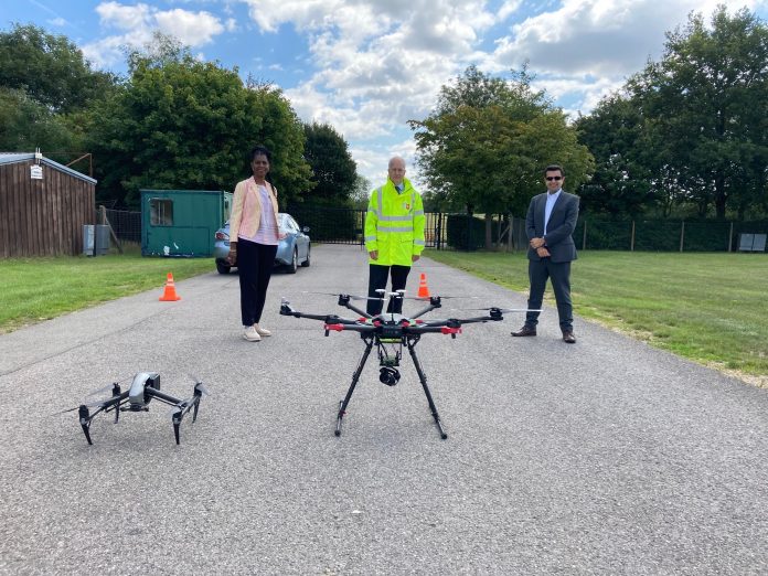
Working with Collins Aerospace, Amey is using the footage taken from drone technology to further assess whether there are any issues on network and to better understand the condition of its assets.
Images from the drone can be taken from a range of heights, providing information of any preliminary cracks in the road surface, enabling the teams to carry out minor repair works.
Understanding roads and assets
Kent County Council cabinet member for highways and transport, Michael Payne, said: “This is an exciting opportunity for Kent allowing us to have a much better understanding of the condition of our roads and assets across the county.
“With this new eye-in-the-sky technology we could have a quick and clear idea of what needs to be done, and where, meaning we will have the information at our fingertips rather than people simply reporting problems to us online.
“Ultimately this will lead to residents having a better experience on Kent’s roads. I look forward to the results of this trial and we will continue to work with our national partners in government and the aerospace industry to take this forward.”
The trial, which is part of the Association of Directors of Environment, Economy, Planning & Transport (ADEPT) SMART Places Live Labs programme, will look at how effective the drone technology can be for highway inspections with the project potentially proving the case for it to be used more widely in the future.
Identify potential defects early
David Matthews, Amey account director in Kent, said: “Using drone technology to inspect the roads will help us identify early on any potential defect issues, enabling us to react earlier and avoid larger repair works which in turn will reduce the disruption for road users.”
Russell Coleman, head of market and business innovation for Collins Aerospace, added: “By effectively creating a Digital Twin representation using data collected from remote sensors, in this case drone platforms, we can offer an evolving digital profile of the historical and current condition of assets.
“Kent County Council are pioneering the use of this technology and Collins Aerospace are proud to help them on that journey.”


