In the second of a series of interviews with Carl Green, Head of Engineering Services for Wyre Council, we follow the progress throughout the construction and operation of the Fylde Peninsula Coastal Programme
The Fylde Peninsula Coastal Programme (FPCP) is a partnership between Wyre Council, Blackpool Council, Fylde Council and the Environment Agency. It is responsible for managing the Fylde Peninsula’s coastline and reducing risk of flooding to people and the developed, historic and natural environment. The new defences will protect 12,000 properties in total – 7500 in Rossall and 4500 in Anchorsholme, plus critical drainage and transport infrastructure.
Carl explains to PBC Today how the project is progressing compared to the team’s expectations…
“We were surprised at the lack of interoperability between CAD packages as well as the limitations of exporting models and data to IFC and other formats. Initially, this caused us a great deal of concern as we were worried that critical data could be lost or be too difficult to find on a scheme of this scale.
“To help define and then address this challenge, Rob Umphray from Sitedesk suggested a situational questioning workshop. The aim of this exercise was to identify all of the situations that could arise during the lifetime of the asset in order to define the data sets and data sources that would be required to effectively manage each of these situations should they occur. This exercise provided us with an information template that we could work to, as well as a legend to work from when we need to recover the information. We were surprised by the number of permutations that resulted, ranging from the relatively benign to complete disaster scenarios.
“One of the early outcomes of the exercise was that there are lots of data sets and information buried at different levels in both the models and drawings. This disparity, allied to the challenges of interoperability may have made it challenging for the team to get the information that they needed.
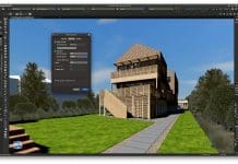
“We solved this issue by overlaying a 3D grid over the entire area of each of the original models (see image above). The grid allows us to separate what are very large schemes into smaller segments which were aligned to the topography of the scheme. This way the relevant data sets are constrained to a smaller area. The data is presented in line with our scenario templates so should someone be maintaining the lifebelts, it is simple for them to find anything they need. On the other end of the scale, should there be a massive storm that damages the defences, we have all of the information that we need to reconstruct or repair as necessary, related directly to the area of the damage. The grid also helped mitigate some of the risks identified by interoperability concerns. Critical data sets could be re-entered if required to ensure that all of the right data was in the right place before we needed it.
“One of the biggest successes arising from the exercise was that it provided us with a template that made it simpler for the Balfour Beatty staff and council officers to capture and relate the required groups of information to each area of the scheme. It also allowed the data to be captured and logged once, avoiding a duplication of effort. The grid system has also made it simpler to validate the information, as this too is completed on a grid by grid basis.
“The exercise also made us think about and define our workflows, particularly in relation to planned maintenance schedules and how we cope with expected reactive maintenance. We are already creating bespoke digital forms for each of these workflows so in the event of any planned or expected reactive maintenance, we can automatically assign the work to a council officer or subcontractor with the correct information and drawings.
“The Sitedesk software www.sitedeskconstruct.com contains a form creator as well as a time and user-based task assignment system. This provides us with the ability to integrate all of the benefits of the 3D design and virtual construction process into our asset management and FM processes, without the cost of an FM system or the data integration costs. We see this as a massive plus which keeps the model and the data alive.
“We will shortly be completing the Anchorsholme scheme and the Rossall scheme is progressing at pace. The grid scheme has also helped minimise errors by breaking a large scheme into understandable pieces which has helped make the evolution into BIM workflows far less challenging.
“Moving forward, we are considering expanding the ways to use the model and the system. We are already incorporating pavement and lighting maintenance, lifebelt maintenance, statutory sand level measurement and compliance, but there is no reason that we cannot include environmental surveys, litter surveys, water quality measurements, fly tipping and graffiti hot spot identification, parking meter maintenance – the list seems almost endless”.
Lessons learned so far…
For Green, the biggest lessons learned so far are:
- To work with the entire team to identify and define all of the scenarios that the asset may encounter throughout its lifetime;
- To use these scenarios to understand, define and map the combinations of data that are required to manage each situation and keep the map in case an unidentified scenario arises;
- To ensure that the relevant data sets are easy to populate and verify for those entering the data as well as simple for current and future users to find and use.
Carl Green
Head of Engineering Services
Wyre Council
Carl.Green@wyre.gov.uk


