FARO has announced the launch of a firmware update to the FARO® ScanPlanTM solution to better address the workflow needs of AEC professionals
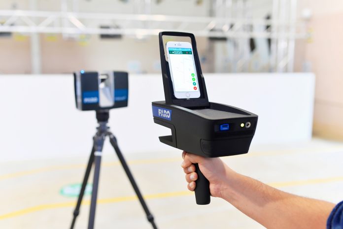
This next generation handheld scanner was introduced to the market as a lightweight, 2D handheld mapper to quickly and easily capture and visualise 2D floor plans.
Now, with new features such as the ScanAssist, Scan Localizer and PanoCam functionalities, AEC professionals can save time and money using the ScanPlan to gather a fast and accurate overview of the scan site or building. Specifically, architects, service providers, construction managers, facility managers as well as real estate agents benefit by determining efficient scan project planning – pre-placement of stationary scans – which results in efficient scan effort estimations and scan job preparations.
ScanAssist
The ScanAssist feature allows users to create more accurate quotations in less time. ScanAssist automatically calculates the best laser scanner positions based on the recorded 2D map. Information about the size of the building as well as needed number and positions of single scans ensure comprehensive coverage of the scan site and fast overview of the scan situation.
Scan Localizer
The Scan Localizer functionality facilitates the pre-placement of individual scans especially when missing scan overlaps impede the proper registration of 3D scans. By transferring the ScanPlan position to a FARO Focus Laser Scanner, single 3D scans are already pre-positioned to simplify and accelerate the ensuing registration in FARO SCENE software.
DXF File Export
This DXF file export functionality allows direct usage of the captured 2D map in the customer’s target application. The data is useable in any CAD system for further modelling without additional conversion for a smoother and more efficient workflow.
PanoCam/VR functionality
With the PanoCam users benefit from panorama images, localised in the floor plan, to get a 360° overview of the captured area. All stakeholders get immediate access to the captured data after export into SCENE WebShare Cloud. What’s more, export functionality to the Present4D VR Suite allows customers to experience the captured images in virtual reality (VR). The VR presentation is readily available in just a few minutes without any additional effort once the capturing process is completed.
Andreas Gerster, vice president global construction BIM at Faro, said: “Since the initial release of the FARO ScanPlan we have continuously worked on further developing our 2D handheld mapper capabilities.”
“With this new firmware update, especially with the ScanAssist and Scan Localizer additions, the ScanPlan – together with our FARO Focus Laser Scanner – further builds upon our Traceable ConstructionTM on-site capture proficiency.
“We have accelerated the 3D capture workflow and made it straight-forward for our AEC customers. For buildings in particular, the ScanPlan is easy to use and ideal to create efficient floor plans. The operation is as simple as walk, point and capture so the level of expertise and training required is minimal.”


