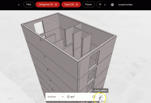
A two-year research and development project to connect geospatial data and BIM information has unveiled the findings at the GeoBusiness show
A joint research project from PCSG, Ordnance Survey and GroupBC has revealed its findings. The project into geospatial data ran over a two-year period and was set up in response to the PCSG’s call to connect BIM and geospatial information. The challenge was launched in 2015 by PCSG’s Technical Director, Adrian Burgess.
GeoConnect+
The two-year project saw the development of a cloud-based platform called ‘GeoConnect+’, which aimed to help asset owners and operators manage large, disparate estates more efficiently.
GeoConnect+ works by connecting asset information with geospatial data sets. This includes OS open data, OS mapping data, land and property data, as well as flood, river and road network data.
One of the main upsides of the technology is that it enables all users to access home grown spatial data that is usually only available through systems used by GIS professionals.
Furthermore, the platform allows the federation, navigation and interaction of point clouds, models and geo-spatial data in context with the asset’s surroundings via a 2D and 3D browser-based viewer. This includes combining the outside world with data about the inside
The research project focused on the areas that made up PCSG’s call. This included the ability to discover what assets, spaces, systems and components were in an estate and where they are located; the ability to connect asset data to geospatial datasets to provide insight into ground conditions as well as environmental constraints; and the ability to share BIM and geospatial data with various supply chain organisations securely.
The project put the Ordnance Survey’s data infrastructure, which was set up to allow controlled access to digital mapping information via new Application Programme Interfaces (APIs), through its paces. It also made use of GroupBC’s semantic BIM server to connect asset data with external third party data.
Paul Griffiths from Ordnance Survey explains: “The theory being tested is that connecting data about thousands of geographically dispersed assets with geospatial, environmental and socio-economic data will be a key enabler and lead to significant savings through being better informed and the ability to make more cost-effective decisions.”
Connecting BIM information and geospatial data
GeoConnect+ is already proving its worth to some early adopters, although more testing needs to be undertaken to fully understand the value of connecting BIM and geospatial data sets together.
Paul Meredith, Information Manager, Thames Water said the system was benefiting his organisation.
“Our GeoConnect+ tool is directly linked from our Common Data Environment and this gives staff quick and very easy access to verified data and information about the environment,” he added.
“This not only speeds up project delivery, particularly during the options stage, but also means a significant reduction in project risk. We are excited about the possibility of using Geo Connect+ to produce address lists and as a possible interface for site-based and mobile staff to load and access site documentation.”


