Through a combination of its highly experienced, knowledgeable personnel and the latest cutting-edge technologies, Murphy Surveys is at the forefront of delivering expert survey solutions. Commenting on the growth and expansion of the company since its foundation, Kai Duebbert, Managing Director of Murphy Surveys explains:
“We’ve grown considerably and established ourselves as one of the leading surveying companies in the UK, with a portfolio of longstanding clients who return to us for our full range of surveying services. We work with our clients to find the best approach for them – this is achieved through direct consultation with the client to find appropriate solutions to fit their projects and budget. A lot of effort is invested into working with the client to make sure that the whole system is designed properly to meet their needs.”
Project Profile
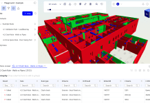
Murphy Surveys recently completed a project at Kidderpore, Hampstead which involved the survey of 15 Grade II listed buildings, as well as the surrounding land and all utilities services. The project began with a precise survey control. Murphy’s then scanned the area using a high definition 3D terrestrial laser scan and produced high dynamic range 360 panoramic imagery. Collaborative pointcloud viewing (TruView) was produced prior to production of 3D parametric BIM.
Heritage projects such as these pose very specific challenges; the random and varied nature of each building means each one has its own levels, spaces and details. Murphy Surveys were able to overcome such hurdles due to the experienced nature of both the surveyors involved and the BIM modelling team. Collaboration was key to producing the model.
Windows and columns in the buildings were all varied and extremely ornate. Custom families had to be built for each type of window which included items such as glazing bars, metal security bars and grills. Reveals and stonework surrounds of a widely varied nature across all 15 buildings were also required. Point clouds were incorporated into the model to ensure the utmost accuracy when it came to modelling the existing surfaces. Modelling took into account the verticality and horizontality of the walls, ceilings and floors. Sagging often occurs with heritage buildings and existing structures; this was taken into account when these were modelled.
The ability to view point cloud scans of the buildings using TruView allowed clients and design teams to view the rich real time laser scan of the existing structure internally as if they were navigating in Google Maps Streetview. Of vital importance is the ability to pan and zoom around the scans and view from each scanner position. This is invaluable in saving time, as there were no site return visits. It also allows quick, efficient and accurate collaboration.
Aside from being a visually accurate model of the buildings on the site, relevant information was also inputted to the model. This included information such as customised parameters, which allowed the BIM modellers to note various conflicts or notes regarding the model. Any items that were unknown or deviations from real world conditions were noted in the relevant walls and surveyed surfaces that were in the model, while other deviations and comments from both surveyors and the modelling team were also inputted to the relevant object properties for tracking and usability purposes.
Once parameters like these are created and used consistently by all, filters and schedules can be set up easily in the model file which allow the client and other users to isolate and filter all relevant objects in the model, even those that contain particular notes and information. We can then view such objects at a glance, instead of trawling through a drawing looking for inaccuracies or deviations manually and comparing these against other information. This is essential on large projects like this in order to cut down on time spent checking over models and drawings.
At its most basic level, this allows errors or difficulties in a survey to be highlighted quickly and therefore tracked. It is essential that such notes and tolerances are kept track of in the model in order to improve the accuracy and collaborative nature of surveying. Creating and maintaining good and accurate data, with the help of notes and comments, helps identify objects of interest other than just the visual. This means schedules and spreadsheets can be generated for both asset management and fabrication purposes, as well as surveying real world physical conditions.
This process allows valuable information to be more viewable to everybody and highlights how important BIM can be. Aside from creating 3D representations of the built environment, BIM allows all information to be kept in a single model or environment. Instead of collating various sheets, CAD drawings and specifications in various IT systems or cabinets, this single model significantly reduces waste, time spent on return site visits and ultimately costs.


![[Video] Fireco: 80 new fire doors required for residential flats in London](https://www.pbctoday.co.uk/news/wp-content/uploads/2025/04/2024-06-01-Lords-view-one_1200x750_004-218x150.webp)


