BIM is only as good as the data that underpins it. Paul Blewett of leading PropTech firm Landmark Information discusses the importance of getting it right
At Landmark, when we’re asked to explain BIM to our investors, we can easily tell them that it’s a collaborative way of working, underpinned by digital technologies, shared information models and reliable and licensed data.
But what does that really mean, and which bit is important? Collaboration – yes of course, this ensures coverage is complete, timelines are hit and compliance is met.
What about sharing and technology tools? Again, these are great at the planning and validation stage.
But what’s the most important part, the thing that needs to be correct, and if flawed at the start can slow the whole project down and ultimately cost everyone time and money if it’s wrong? Data.
There is much talk about open data in the market; in fact, we frequently have conversations with customers about what we could provide them to be more cost-effective and the resounding message we receive back from our customers is that they don’t want cheap data, they want accurate data. This is important whether you’re working on a £5,000 extension or a £5m commercial build.
As raw data continues to become open and freely available, it quickly becomes unsupported by the originator. Do we want to live in a world where in 10 years’ time geospatial data is free, but it’s so flaky that you can’t trust it? How does BIM governance work, then, when it’s laid on top of this potentially variable data foundation, and who is responsible for its success?
This is interesting as with the provision of any data, there is always going to be cost borne from ensuring validation, interpretation and indemnity. The latter is critical as it should be offered to protect the user against any downstream effects of the data being wrong. This is a guarantee that open data simply doesn’t and couldn’t have, without the intervention of Innovative PropTech companies such as Landmark.
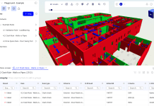
 Formatting can also be raw and unwieldy for the average user who hasn’t got GIS qualifications; indeed, customers often need help cleaning and packaging this all up in a way that they can easily access and use. This is a challenge some of our customers in the architecture space have told us about when creating their BIM level 2 models; they’ve retrieved the project data from different sources then the merge process can become complicated, and the end result unexpected.
You could liken this to buying a new cashmere jumper – you have the choice of buying a beautifully made one, off the shelf, or if you have the wool, pattern, sewing machine, skill and time you could of course make one yourself. In doing so, there’s no guarantee it’s going to turn out the same as the one you could have bought, so it’s not really a viable option. You ultimately want the quality jumper that comes ready to wear – and with a guarantee from the manufacturer.
The same could be said about buying raw open data; is it really what you need as, like the jumper comparison, you may find your project ‘unravelling’ very quickly if not handled correctly.
At the recent MIPIM event, we met with land and infrastructure owners building a digital estate: secure portals of their existing infrastructure, which can be securely accessed through a portal by any design and construction partners.
They showed us some really innovative sites, using the latest tech, workflow and case management tools, but the thing they really needed help with was data – data fulfilment, data processing, data licensing, data testing, data governance, data security, data compliance.
They soon realised that the foundation for what they had built was based on open and unvalidated information, producing large spikes in maps or volatile results around risk or land interpretation.
Landmark produces market-leading tools and services in all its fields, but we are also experts in the underlying data that underpins all of these services, making sure it’s right and fit for purpose. This is why we’re the market leading PropTech data company in the UK right now.
At Landmark, we’re currently experimenting with Artificial Intelligence to help us to solve the problems of tomorrow, today. We’re developing tools that help to highlight and interpret features from both GIS and raw data, and combine these in intelligent ways.
But you can’t set up complicated machine learning against data sets you don’t trust, and if the data hasn’t been robustly tested, in the way that Landmark currently does for Ordnance Survey’s Mastermap for example, then the whole thing would be liable to fail.
Handling big data and the compliance and legislative issues around this is also something we are very used to. As increased searches are required throughout the purchase and design stages of any project, more data requires careful handling, which we can do through one licence covering all interested stakeholders, layered data, one address search and multiple formats, and ultimately providing compliance confidence to all data users.
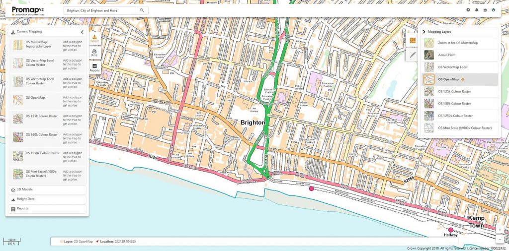
As we advance our market-leading digital mapping service Promap this year, our main focus is to ensure that all of our customers across the planning and build space can still do everything they need to, only quicker and easier. We’ve achieved this and the exciting thing is that the new phase of customer discovery we are now underway with, bringing the AI we mentioned into proceedings and working with our extensive customer base to ensure that we tackle the issues close to their hearts, will bring something truly game-changing for BIM users in 2019.
If you’d like to arrange a free trial of Promap V2, to see how the data, features and functionality could bring your next project to life, get in touch with me on LinkedIn and I’ll get you up and running.
Paul Blewett
Head of Product
Landmark Information
Tel: +44 (0)844 844 9960
Twitter: @Promap
LinkedIn: Paul Blewett
Please note: this is a commercial profile.


