Jonathan Tarbatt, director of architectural practice Corstorphine + Wright, sets out, in no particular order, his top five masterplans and what lessons they offer for successful placemaking
“Make no little plans – they have no magic to stir men’s blood.”
– Daniel Burnham, noteworthy US architect and urban designer (1846-1912).
Setting aside the gendered nature of Daniel Burnham’s quote, it speaks to a deep-rooted tension in masterplanning practice between the “grand vision” of what place could look like when it’s “finished” and what a place that grows incrementally might become. The first version is top-down and relatively static, the second bottom-up and more open ended, but also uncertain in its outcomes.
The common thread running through my top five masterplans is that they navigate a middle way between deterministic and emergent approaches to placemaking: each reconciling these two divergent agendas in their own unique way to create better, more adaptable, lively and resilient places.
Savannah, Georgia (1700s)
Georgia’s been in the news a lot recently, but most people don’t realise its capital – Savannah – is one of the world’s most beautiful cities, much less that its enduring success is founded on the ingenuity of its 18th century masterplan.
 Gridded layouts are ubiquitous in US cities and Savannah follows this trend, albeit with an ingenious twist. Rather than rolling out a “dumb” grid of rectangular or square shaped blocks as in the case of most US cities, Savannah introduced a subset of blocks called wards. The ward is a kind of “superblock” with an administrative function made up of a repeating module of smaller blocks, each imbued with its own hierarchy of movement, form, function and open space.
Every ward was laid out with a public square at the centre. The western and eastern sides of the square were flanked with plots reserved for civic and commercial buildings. The northern and southern sides were reserved for houses. The 40-house plots in each ward were arranged as row blocks with a shared alley or service lane. Because the house plots lined east-west streets, the wards were thus united visually and, of course, houses lining the edge of one ward faced the houses lining the edge of the neighbouring ward as well. The first wards were laid out in 1733 and became the centre of the growing town, but the module was used for later expansion well into the 19th century.
Much has changed in the intervening years, yet the masterplan’s inherent adaptability has sustained a thriving historic downtown district.
Nørrebro, Copenhagen (1890s)
Responding to an emerging housing crisis in Copenhagen its city engineer Charles Ambt proposed a new urban extension deploying an artful composition of large-scale perimeter blocks, each enclosing a big communal courtyard. At first glance, his masterplan lacks sophistication yet a second reading reveals a playful – even wilful – nod to the picturesque that embodied then emerging Garden City ambitions to combine healthier living conditions in a beautiful environment, rather than a cramped and repetitive grid characteristic of many European cities of the day.
 The masterplan features continuously enclosed perimeter blocks beloved of urban designers today for their “street-facing” qualities. Each block is essentially a single building, however, and this feature further distinguishes Ambt’s plan from traditional city making, where blocks were usually set out in orthogonal grids and subdivided into plots for incremental development.
Though it created more varied and interesting streets and spaces than a traditional gridiron, the result nonetheless is seemingly deterministic and resistant to change. But the outward austerity and formality of the blocks belies a uniquely Scandinavian approach to block planning, whereby the internal layouts of the apartments can be arranged so that the principal rooms either face outwards to the street, or inwards to their generous park-like courtyards. This subtly subverts the traditional approach to perimeter blocks that clearly distinguish between “fronts and backs” because it allows occupiers to decide themselves whether they face the public realm of the street, or the communal realm of the courtyard.
The blocks are large enough to do both well, and the relative hostility of the winter climate in these latitudes makes this approach seem all the more sensible. Above all, in extending the pre-existing urban fabric using city-scale blocks, Ambt’s masterplan achieved what mainstream Garden City and Garden Suburb masterplans of Parker and Unwin in the UK and their innumerable followers never could: sustainable densities in accessible locations.
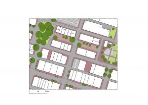
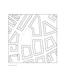
Temple Bar, Dublin (1990s)
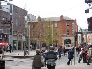
Much has already been written in praise of Temple Bar and the work of a talented group of architects who came together from different practices as Group 91 to formulate their competition-winning entry for the renewal of what was then a down-at-heel part of the city centre earmarked for wholesale demolition.
Their sensitive yet unashamedly modern interventions and insertions – including two new squares and a curved street – represents the masterplanning equivalent of keyhole surgery and has stimulated the regeneration of the area as arguably Dublin’s most successful quarters.
 In some respects, the quarter came to suffer from its own success. Its renaissance attracted too many stag and hen dos but with the cooperation of bar owners, its insalubrious reputation has since receded. It is now more deservedly known as home to such cultural attractions as the Irish Photographic Archive, Gallery & Photography School, the Irish Film Institute, the Project Arts Centre, the Gaiety School of Acting, the Ark Children’s Theatre and the Contemporary Music Centre. Temple Bar has something for everyone and it remains a good night out. On that basis alone (pandemic permitting) it merits revisiting.
Ijburg, Amsterdam (2000s)
When the Dutch run out of development land, they have a habit of making more. Ijburg is a collection of six new manmade islands sitting in Amsterdam’s Eastern Harbour. The municipality not only reclaimed the land, it prepared its own masterplan in collaboration with local practice de Architekten Cie. Taking their hands-on approach one step further, the municipality also forward funded the enabling infrastructure, which was likened to “rolling out the red carpet” and even employed a “block coach” to coordinate the input of different architects.
The masterplan itself is interesting for two main reasons: first, the involvement and control of the municipality as landowner, enabler and masterplanner, allowed it to promote self-build plots as a means whereby individuals, cooperatives and low-volume developers could buy and develop small plots or groups of plots according to their own wishes. For its success, this depended on the second most feature of the masterplan – its underlying grid. Although the manmade islands are irregular shapes and sizes, the masterplan imposes an orthogonal grid of different size blocks which is simultaneously robust and inherently efficient.
Thus, while at first glance the grid appears simple, it opens up a wide variety of possibilities. Paraphrasing the masterplanners: “The grid forms the connecting element, but at the same time makes a variety of functions and therefore various block shapes possible. Public spaces, a market square and two parks are projected at regular distances and are connected to the longitudinal streets in the plan. An internal waterway cuts through the grid, opening up the structure of the otherwise closed blocks. The plan also includes space for strikingly situated buildings called ‘solids’, which are suitable for a wide variety of programmatic functions.”
Without its plot-based approach, this might otherwise have resulted in a sense of monotony relieved only by the masterplan’s open spaces, canals and waterfront areas, but with the variety and diversity of building designs, styles, shapes and sizes, the area has instead blossomed into one of the worlds’ most interesting and lively new neighbourhoods.
Drumchapel, Glasgow (2018)
Unfettered by fee budgets or the demands of commercially driven clients with low aspirations, this masterplan by students of the Urban Design Studies Unit (UDSU) at the University of Strathclyde is an object lesson in “how to do urban design” for two reasons. First, how to approach a masterplan if it is to take full account of its context and second, how to incorporate learnings from the past without being blinkered by them.
The Urban Design Studies Unit was tasked by Glasgow City Council and Glasgow Housing Association to prepare a strategy and masterplan for the regeneration of Drumchapel.
Founded upon a forensic analysis of the area’s historic, socio-economic and physical context, the masterplan seeks to demonstrate how a “redensifed” place could be achieved.
It builds on some of the existing urban armature, with its challenging topography and aspires to deliver a vibrant, diverse and liveable neighbourhood that “…is robust and resilient in its structure and flexible and fluid in its delivery”.
The masterplan itself is not groundbreaking but this is part of the point: masterplans that are groundbreaking tend to become part of the problem rather than part of the solution.
The need for regeneration of Drumchapel has emerged in large part due to the failed modernist housing experiments of the 1940s, 50s and 60s that blight large swathes of the UK today. That doesn’t mean there isn’t room for innovation, far from it, but there’s enough water under the bridge already for us to understand what works and what doesn’t.
What’s really innovative about this masterplan is bringing principles established from traditional plot and block-based approaches to development, including locally distinct building typologies such as “colony housing”, back to life.
Jonathan Tarbatt
Director
Corstorphine + Wright
+44 (0)1926 658 444
Twitter: @Cwrightarch
LinkedIn: Corstorphine + Wright


![[VIDEO] Local planning inspector recruitment to begin in earnest in new year A drive to recruit local planning inspectors will begin in the new year](https://www.pbctoday.co.uk/news/wp-content/uploads/2025/12/iStock-2159482095-2-218x150.jpg)

