As part of the Mayor of London’s Civic Innovation Challenge, 3D Repo is tackling London’s housing crisis with a 3D planning portal for residents
London is facing a housing crisis, and one of the key barriers to further development is complicated planning proposals that most people struggle to understand. As a result, new developments are often rejected by residents who may have supported them if only they had been able to understand them. On top of this, engaging with the planning process can be very time-consuming and unpleasant experience. Improving the user experience is critical to allow more Londoners to take part and make their opinions heard.
To tackle this problem, the Mayor of London’s Civic Innovation Challenge was born, offering an opportunity for start-ups and SMEs to work together with leading corporates and public organisations, including Transport for London (TFL), Microsoft, Talk London and Social Tech Trust, to tackle some of London’s biggest challenges. Over 120 entrants took part in the beginning of the Civic Innovation Challenge, gaining invaluable benefits from working with other SMEs along the way.
3D Repo, pioneers of cloud-based platform for collaborative BIM, won the challenge for its use of technology to democratise planning and to tackle the housing crisis facing London with their innovative solution, PlanBase.

Who is 3D Repo?
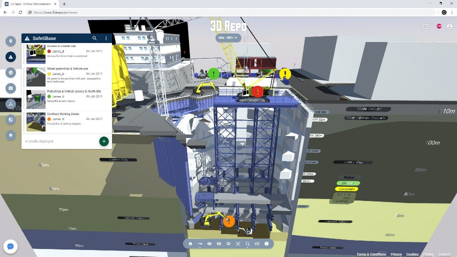
3D Repo is an open source Digital Construction Platform developed for the benefit of the entire architecture, engineering and construction (AEC) industry. Large developments and infrastructure projects are always delivered by specialist companies working in silos. 3D Repo technology brings disparate teams into a single digital platform for collaboration and information exchange.
Democratising planning in London
PlanBase is an open source 3D planning portal based on the 3D Repo Digital Construction Platform. There, residents and planners can review proposals in 3D and comment on them. Same as with interactive 2D Geographical Information System (GIS) interfaces, in PlanBase, users drop pins on a specific topic and provide feedback directly in 3D. This removes the need for residents to email responses back, and for planners to collate and analyse them manually.
Research carried out by 3D Repo uncovered several barriers to participation during community engagement including, firstly, a lack of proper understanding of the proposals by often poorly informed yet information-overloaded public. People interviewed said that there was simply too much information to read through and would much prefer to look at interactive visuals. In addition to this, most people cannot comprehend 2D architectural diagrams.
Secondly, participation is often skewed towards specific groups of people due to factors such as timing and location of consultations. However, planners and developers alike would like participation from all groups of “hardworking local families and individuals” for more representative feedback. Despite online portals getting a lot of traffic, very few comments are submitted.
According to a survey by Talk London which 3D Repo helped to design, more than half of the respondents were dissatisfied with their comments not being acknowledged nor considered during planning. Nearly three-quarters felt that they were unable to influence the developments.
Research also found a need for a narrative especially during Opportunity Area Planning Frameworks (OAPFs) to give better context and understanding.
Based on an online survey by Talk London, a statistically significant and overwhelming majority (87%) of Londoners care strongly about the developments and would want to engage with planning if it was easier to do so, ideally in 3D (70%). Key issues include impact on the environment (61%), local community (45%), aesthetics (44%) and affordable homes (39%). In written responses, other issues such as lack of available parking in new developments featured strongly, too.

Planning in 3D
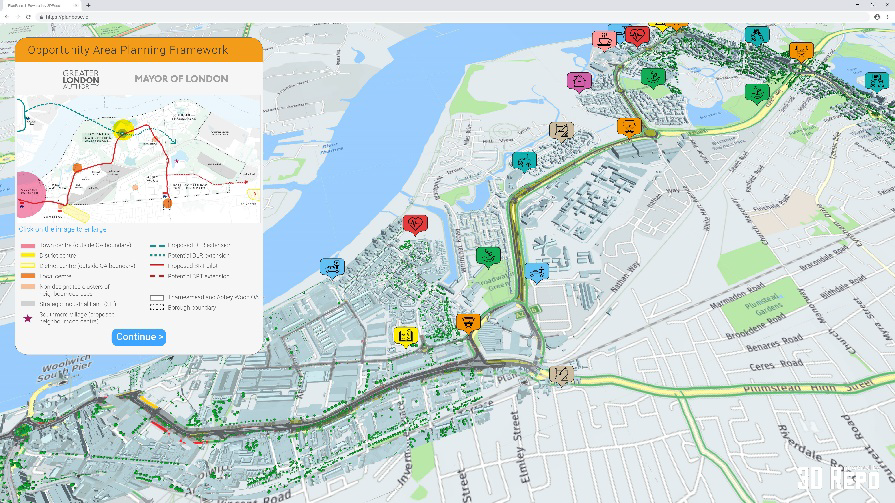
Currently, PlanBase is being built for a pilot trial by stripping down the engineering complexity from the 3D Repo BIM platform in order to deliver a clean and simple to use interface that anyone without prior experience can engage with. As a case study, 3D Repo used the Thamesmead and Abbey Wood Opportunity Area in London as shown in Figure 2.
This interactive prototype provides the means to test user interaction, preview relevant project information and collect feedback by dropping pins based on specific topics of interest. The key objective was to increase engagement and interactivity while reducing unnecessary clutter.
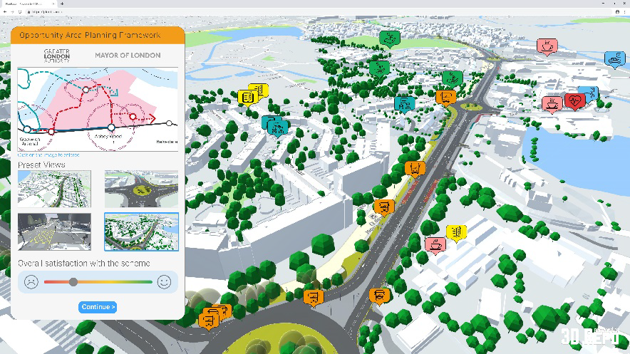
Upon zooming in, users can recognise clusters of comments that highlight increased activity. They can also navigate to areas of interest using pre-defined views on the left-hand side.
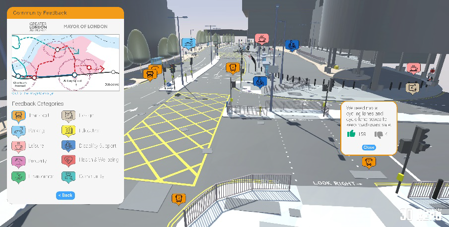
PlanBase street-level provides unprecedented amount of detail. Users can post new comments or up or down-vote the existing ones. These are then automatically processed using PowerBI for automated business intelligence, data aggregation, and statistics in the form of a live dashboard for planners.
During the Civic Innovation Challenge pilot, 3D Repo will develop and deploy the open source PlanBase portal on top of the 3D Repo cloud back-end that will be totally free to use for everyone.

The benefits of planning in 3D
Planning in 3D will bring a wealth of benefits for local communities, GLA and local councils, and developers. Local councils will have a better understanding of the planning proposals and the wider narrative within the context of the whole city, including public transport. On top of this, they will be able to give specific feedback with relative ease. GLA and local councils will have better engagement with local communities, better analysis and data mining, as well as fulfilment of the National Digital Twin Programme requirement. Developers will be able to better communicate proposals and more easily gather feedback on them. They will also benefit from faster iteration of changes.

How it helps?
Large developers upload 3D models to be rendered online within the context of the existing conditions.
Local planning authorities and residents review the submissions and comment on them directly in 3D depending on topics such as design, environment, property, transport, education, health, community and leisure.
3D Repo’s 3D Diff change detection tool then highlights exactly what has changed between the revisions.
By storing all the submissions, GLA, 33 London boroughs and British Land will build a National Digital Twin of London.
Existing 3D Repo APIs provide additional business intelligence and feedback aggregation without any human bias or tampering, improving on transparency and accountability.
The same portal is then used for project delivery so that the site managers continuously publicise their project progress while the general public provide feedback related to noise levels, traffic restrictions, etc.
If you would like to know more about 3D planning, PlanBase, or 3D Repo’s cloud-based BIM platform, feel free to reach out to the team.
3D Repo


