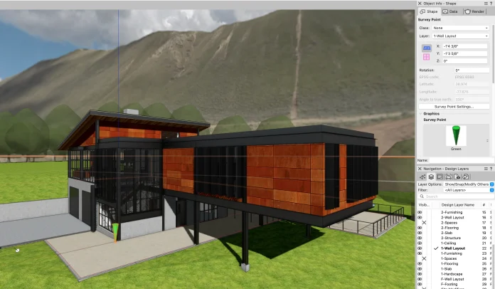
Establishing an agreed project center, outlined in the BIM Execution Plan, can be achieved in various ways within Vectorworks, depending on the desired workflow
Collaborating on projects involving model and coordinate data exchange requires a shared reference point for integrating geometry from different design team members or other parties creating BIM models.
Read onwards to discover the keys to ensuring file coordination with collaborators who use software like Revit, AutoCAD, SketchUp, or any other design solution.
Origins
There are two origins to consider in Vectorworks: the Internal Origin and the User Origin.
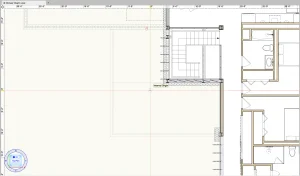
Internal Origin: The Internal Origin is what you see when you open a new Vectorworks file. It’s a datum point for your project which you assign variable coordinates relative to the location of the User Origin. Vectorworks exports relative to the Internal Origin. You should be designing within a reasonable distance to the Internal Origin to maintain file performance.
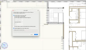
User Origin: The User Origin is at the same location as the Internal Origin when you open a new Vectorworks file. The User Origin can be defined relative to the Internal Origin — the User Origin’s coordinates will always be (0,0), but by moving the User Origin, you’re effectively giving coordinate values to the Internal Origin.
Georeferencing
Georeferencing is the process of aligning a model’s internal origin and geometry with a precise location on Earth. By enabling and configuring georeferencing, each design layer synchronizes its coordinate system with a geographic coordinate system of latitudes and longitudes or eastings and northings.
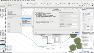
In Document Settings > Georeferencing, you can choose a coordinate system and define the Internal Origin’s location and rotation.
True North
To work in True North rotation, you simply need to set up the model to its real-world orientation, with north pointing up on your screen. The Rotate Plan function, which is essentially a temporary model view, allows you to set up specific views aligned to the main building axis and can help with modeling and drawing. Think of it as rotating a paper on the drawing board to see the building at the desired angle.
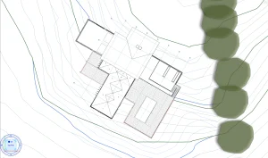
Plan rotations can be stored in saved views, so you can always come back to that convenient orientation. You can also set rotated views per each Viewport on Sheet Layers.
Project North
The project north view shows object rotation as different from how it is in the real world and seen on a map. In this view, a project is set up so its building axes, structural grid, and the orientation of main building elements are aligned horizontally and/or vertically with the screen.
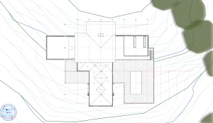
In certain architectural projects, it is common to consider the building as the focal point of orientation and adjust views based on prominent axes. By aligning the plans with the building in an orthogonal position, project north signifies a key building axis pointing towards where north would be on a map.
You have the flexibility to model at any project north angle and then use georeferencing settings to define the angle to true north. This adjustment compensates for any variations in angle, ensuring that any exports from Vectorworks are accurately rotated.
BIM Coordination
A BIM Execution Plan (BEP) typically establishes a project datum as a designated and agreed-upon coordinate for spatial coordination. This X, Y, and Z value serves as the crucial point that every model created in a BIM authoring software must export in relation to, ensuring that when federated, all models from various disciplines seamlessly align in their true real-world positions.
IFC Export settings under the Model Setup tab allow you to set the georeferencing, origin, project elevation, and true north rotation of the IFC model to match the document settings that have been already setup in the file as described above.
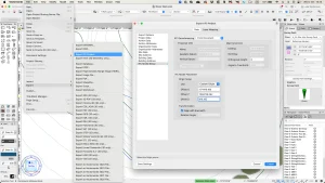
In case none of those have been set up in advance, you have the option to manually enter project datum coordinates, rotation to true north, and project elevation. In this way, even if you’re working from an origin set to (0,0) and in project north orientation, you can define correct parameters at the point of export to ensure seamless collaboration and integration with the work of others on your BIM projects.
Vectorworks 2025 Feature: The Survey Point
Introduced in Vectorworks 2025, the Survey Point allows you to define a surveyed point in the real world by inputting coordinates. You can link a Survey Point with the internal origin and use it to define real-world location and orientation in new projects and in projects that need fixing because they don’t align correctly with project coordinates.
You can learn more about the Survey Point feature with a free Coffee Break session hosted by Vectorworks experts. These sessions are short, casual, and 100% online.


