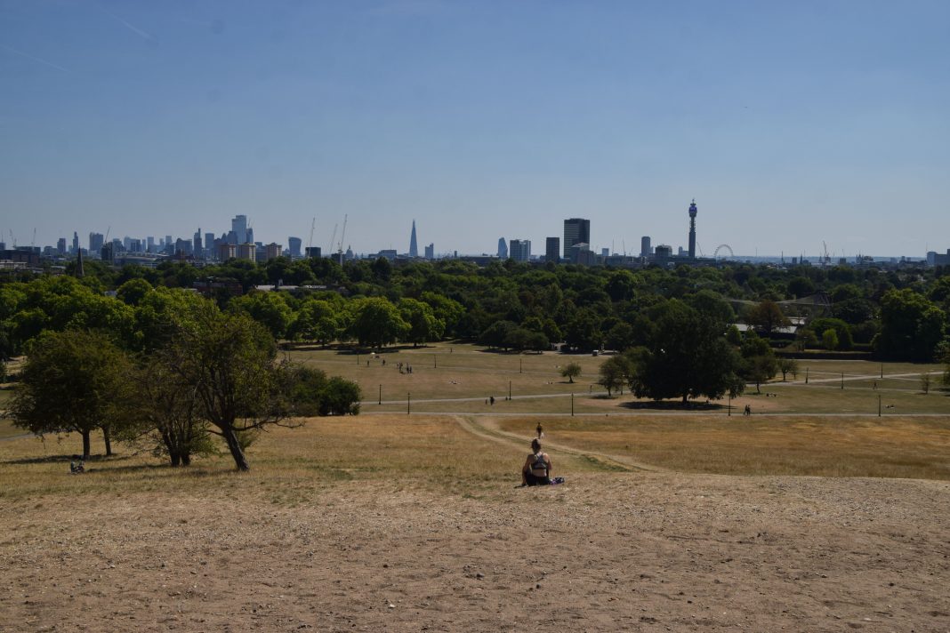
A new heat modelling tool from Arup compared extreme urban heat islands in six major cities, finding that a quarter of a million vulnerable Londoners live in the “hot spots”
A new urban heat modelling tool has found that London has the joint-fourth most extreme urban heat island (UHI) “hot spot” of six major cities around the world, with temperatures 4.5°C hotter than rural surroundings.
Arup’s Urban Heat Snapshot mapped the most extreme hot spots in a 150km2 sample of the urban centres of Cairo, London, Los Angeles, Madrid, Mumbai and New York, using satellite images and AI.
The findings bring to attention how the eradication of green spaces and excessive use of steel, glass and concrete in our cities have increased the impact of heat on different neighbourhoods- and how this could be reversed.
The data was taken from the hottest day in each of the cities in 2022
| City and most severe UHI effect | Most severe UHI Hot Spot location | Coolest spot | Temperature difference between hottest and coolest spot in the surveyed area |
| Madrid: UHI 8.5°C (Evening, 15/06/22) | Plaza Juan Pujol (3% vegetation / 0% water) | The North of Casa de Campo (89% vegetation / 0% water) | 8°C |
| Mumbai: UHI 7°C (Afternoon, 16/03/22) | Ghatkopar East (39% vegetation / 0% water) | Maharashtra nature park (21% vegetation / 74% water) | 8°C |
| Cairo: UHI 5°C (Evening, 11/06/22) | Bulaq Ad Daqrur (0% vegetation / 0% water) | South of Qorsaya Island (Pharaonic Village) (28% vegetation / 30% water) | 6 °C |
| Los Angeles: UHI 5°C (Afternoon, 04/09/22) | West Lake (5% vegetation / 0% water) | E Debs Regional Park (96% vegetation / 0% water) | 5 °C |
| London: UHI 4.5°C (Night, 19/07/22) | Kilburn/ South Hampstead (38% vegetation / 0% water) | Regents Park (89% vegetation / 1% water) | 7°C |
| New York: UHI 4.5°C (Afternoon, 09/08/22) | Washington Heights (3% vegetation / 0% water) | Ferry Point Park area (77% vegetation / 1% water) | 4.5°C |
Arup’s Urban Heat Snapshot builds on an advanced climate model by the University of Reading to demonstrate how advanced digital tools can bring academic models to real-word scenarios to find the causes of the UHI effect.
It can then rapidly model solutions to show how the strategic deployment of nature and other interventions can help cities reduce the impact of hot spots.
This method is much closer to people’s actual experience than cruder satellite analysis of land surface temperatures, which can be skewed by the dramatic highs of heat-absorbing materials on roofs and roads.
Cities are getting hotter due to climate change, with the number of cities exposed to extreme temperatures, 35°C and above, expected to triple by 2050.
Extreme heat killed over 61,000 people in Europe alone in 2022, one of the hottest years on record.
Cities are not cooling in the night effectively either
It is increasingly understood that poorer neighbourhoods are also more at risk to heat exposure, due to factors such as a lack of trees and a lack of air conditioning.
It was also found that three of the cities studied, including London, experienced the worst UHI “hot spots” during the evening or night-time.
Cement absorbs heat throughout the day and then slowly releases it after the sun sets, creating excessively warm nights that can bring stress and health issues. This can especially impact society’s most vulnerable, such as children, the elderly and the homeless.
Within the study area in London, severe UHI “hot spots” meant researchers found almost a quarter of a million elderly people and children are living in urban heat islands, with heat spikes of 4°C compared to rural surroundings. Studies suggest that the risk of death from excessively hot nights could increase to six times that of the current figures.
Vegetation cover had a noticeable impact on urban temperatures
The coolest spots in cities were almost entirely found in parks away from residential and commercial areas and had over 70% vegetation cover from trees and other plants.
The hottest spots in major cities had less than 6% vegetation cover with a significant impact, as seen in London, where the Kilburn and South Hampstead area, with 38% vegetation cover, experienced heat over 7°C hotter than Regent’s Park, with 89% vegetation cover, a short distance away.
Dima Zogheib, nature positive design lead at Arup, said: “We’ve inadvertently designed many of our cities to be hot. We’ve pushed out nature – concreted our streets, built high in steel and glass. And we’ve largely confined our green spaces to grand parks, away from where most people live. Ponds, lakes, trees, grasses, soils and other surfaces that allow water to permeate into the ground have to be seen as vital infrastructure, essential to helping us adapt to climate change.
“Our challenge as designers is to think creatively to strategically and equitably deploy nature throughout our cities. Today we have the advanced digital tools to help us rapidly pinpoint where investment in solutions can make the greatest impact.”
Making rapid heat modelling available to the general public
Survey contributor Dr Ting Sun, UCL, Institute for Risk and Disaster Reduction, said: “Modelling urban heat has been the reserve of the few, mainly those in academia.
“UHeat bridges this gap, drawing on the urban climate science and models developed by academia and combining them with increasing amount of city data available through remote sensing. It gives those on the ground shaping cities the tools they need to rapidly understand the impacts of their design on urban heat.”
The authors of the report recommended cities focus on:
- Implementing nature-based solutions: Nature-based solutions are scalable and affordable interventions for climate resilience. The strategic reintroduction of nature can lower temperatures, improve air quality and enhance biodiversity.
- Creating more permeable surfaces: Permeable surfaces, such as bare or planted soil, tend to absorb less heat compared to impermeable surfaces like concrete or asphalt. Increasing permeable surfaces and allowing water to infiltrate into the ground will cool the surrounding environment. Sustainable Urban Drainage schemes can slow down water runoff during heavy rainfalls, increase areas of green space, and cool neighbourhoods.
- Using every space possible: More than half of the space in cities (including roofs and streets) is open space, providing a large canvas for building resilience. Measures can include greening building facades, greening roofs or using white paint to change the reflectiveness of surfaces to reduce the amount of heat absorbed from the sun.
- Establishing cool islands: With cities set for heatwave conditions every summer we need to create a network of cooling spaces in cities for people to take refuge. For example, in London Arup contributed to the Greater London Authority’s cool spaces map where locals could find opportunities to shelter during hot days in a bid to reduce risk to health from hot weather.
- Sparking behaviour change: People will also need to change the way they live in cities within the next decade. Hot countries around the world have been adjusting their lives to this for centuries, and it’s time to learn from them – incorporate siestas, re-consider office hours, introduce shop and restaurant closures over peak heat.
Nature-based resilience will reduce the impact of extreme urban heat islands
Will Cavendish, global digital services leader at Arup, said: “This study shows that many more people in our major cities are experiencing worrying levels of heat. But now we have AI and advanced digital tools to help us rapidly understand the heat profile of our city at a street level.
“When overlayed with social factors to understand need, this allows cities to be far more precise in building resilience against the effects of climate change. They are allowing designers to show decision makers the exact impact nature-based solutions will have on cooling cities and enhancing city resilience.”


