Modern technology like 3D laser scanning can provide a crucial boost in helping the UK government hit its target of delivering 1.5m new homes
Late last year, news up and down the country discussed three interrelated topics. Britain’s ongoing housing/cost-of-living crisis, a renewed mandate by the Labour government to build 1.5m homes by 2029 (370,000 per year), and growing signs of a slowing economy and rising inflation; a dire duo that gave rise to the term “stagflation.”
Even before stagflation was resurrected from its 1970s slumber, however, the British public and a wide swath of industrial and political naysayers were asking a simple question: just how realistic is building 1.5m homes by the next parliament?
The answer seems to be ‘not very’.
At least not without the help from modern technology like 3D laser scanning.
Making gains, missing the mark
There are many hurdles that UK industries must overcome to meet housing targets. Regulatory bottlenecks, the labour force shortfall to deliver housing on such a massive scale, as well as the question of where these new homes will all be built, are three of the most daunting.
In fact, according to the Centre for Cities, a leading think tank focused on improving the economies of the UK’s largest cities and towns, even under a best-case scenario, the country is predicted to miss its housing construction goal by 388,000, coming just shy of 75% of the actual target. Greater London could fall short by 40% of its goal.
Again, this is an optimal outlook. Taking a business-as-usual approach, with no construction industry workforce gains and only minimal changes to planning committee paperwork and approvals, and it’s likely Labour’s lofty goals risk becoming pipedreams at best.
While by no means a silver bullet, 3D mobile and terrestrial laser scanning technology equipment can assist. These sophisticated precision measurement laser-based tools can save time and money, increase documentation accuracy, and ultimately lead to expedited project completion.
How can 3D laser scanning technology aid housebuilding efforts?
For starters, modern 3D laser scanners, mobile or otherwise, are, on balance, intuitive to use. They also require single operator function, feature a minimal learning curve and can deliver (and share to key project stakeholders) its reality capture data in near real-time.
Modern laser scanners create accurate and dense point clouds, and intuitive cloud-based software solutions, like FARO Sphere XG, offer a consolidated place for reviewing data for faster decision making or progress updates.
The benefits of modern laser scanning are speed and accuracy – not to mention cumulative savings.

As the updated housing initiative stands, new homes will be built on three tiers of cascading priority.
Converting/upgrading existing brownfields – defunct commercial or industrial areas, focusing on high-density cities and near urban areas.
The so-called “grey belt”, an unofficial term denoting subpar areas within established green belts around major UK cities, including London, Birmingham, Manchester, Edinburgh and Glasgow.
And last, new construction on actual green belt land, a contentious issue with detractors and supporters alike.
“Labour-saving” tools
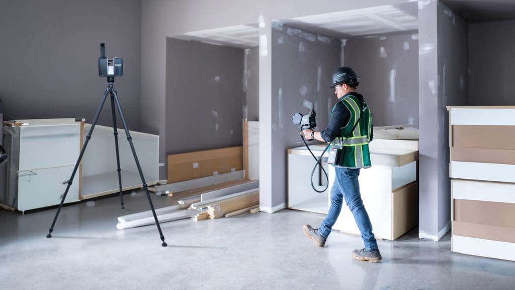
At FARO, we strive to develop market-leading solutions that can accelerate both the evaluation of existing as-built structures, as well as map and measure terrain (above ground and below) for newly planned structures.
By comparing existing structures with their original CAD blueprints, engineers can quickly determine how much retrofit would be required.
Likewise, measuring the slope of the land, identifying the exact location of existing subterranean structures like piping, electrical or plumbing, or the site of future MEP assets, all assist in the government and local councils’ combined efforts to accelerate the construction process.
Orbis Premium is the next step for industry professionals looking to deliver highly accurate results, reduce user impact and increase overall efficiency.
Leverage the power of Flash Technology, which enables stationary scans in approximately 15 seconds and provides excellent detail from a mobile mapping solution — elevated by in-field cloud connectivity with Sphere XG — and UK contractors and subcontractors will quickly realise the power of the tool/s they possess.
The same holds true for the FARO Focus Laser Scanning Solution, which also includes Flash Technology.
Designed as a superior surveying & mapping solution for capturing more accurate terrestrial scan data with high resolution 360-degree photo capture (with its up to 400m range) and smaller areas with its speed of capture, it is the ideal tool for large construction sites and offers greater visibility to earlier error identification and reduced rework and material waste.
Playing a blinder
In either case, reduced need for multiple setups, minimised errors or missed data and faster on-site decision-making all make for increased productivity. Whether it’s topographical surveys, boundary surveys or large infrastructure projects, 3D laser scanning tools like Orbis and Focus truly measure up.
Thus, for construction, civil engineering and surveying professionals who adopt modern methods of working, the “game” is theirs to win. Even with the expense of technology adoption, the return on investment is also clear, thanks to the speed and accuracy boost.
Employed as complementary tools, reality capture solutions like Orbis and Focus just might help the UK meet its ambitious housing goals after all. With the housing deadline only a few short years away, every incremental advantage helps.
*Please note that this is a commercial profile.


